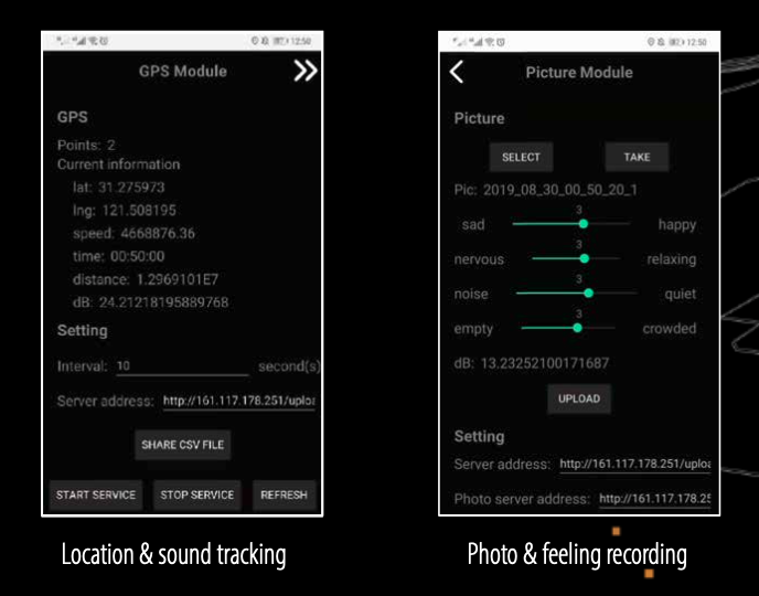
WeSense — A collaborative App to create a built environment database.
While people are passively perceived by external sensors, there is always an absence of sensors to perceive our feedback on the physical environment. Therefore, I launched an application called WeSense on cell phones, which could record our trajectories, surrounding environment and feelings (light intensity, activity behavior in the future) in the space. With digital wearables, it’s possible to quantitate our sensa- tions and share them with others and also with space in real-time. Based on this novel big data source, we could better understand the association between human behaviors and the city space.
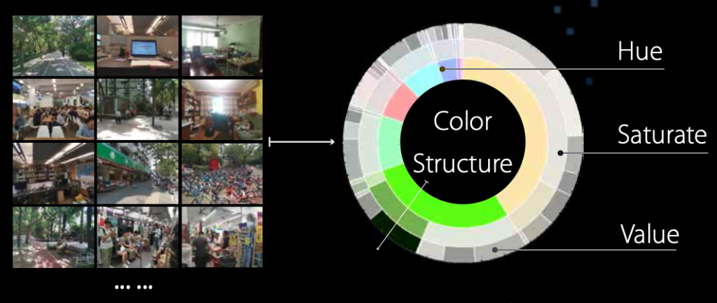
Color environment chart + Location
The App could upload our photos taken in different spaces automatically. After receiving the photo, the server will group the photos based on the location tag and decompose the color structure to analyze how much of different colors we usually see in different spaces. We could also add feeling or mood tags on the photos in the App.
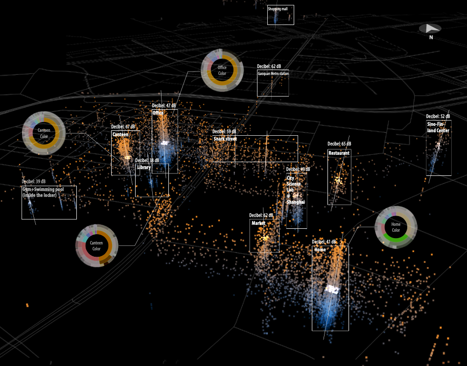
Sound environment map + Location
Another function is to evaluate the decibel of the surround- ings while, at the same time, tracking our location. With this data, we could match the sound environment with the geospatial location. The data can be uploaded to a server automatically. As more volunteers participate in this project, we could map the sound environment in diverse city contexts and manage to explore the relationship between urban morphology and sound.

Case study: One day in Anshan Community
How will different residents in the same neighborhood use public space in one day? With the aid of the WeSense App, I cooperated with 5 residents of different ages in An Shan 4th neighborhood and collect their trajectories in their typical day to see how they interact with the public space.
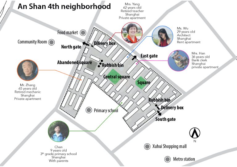
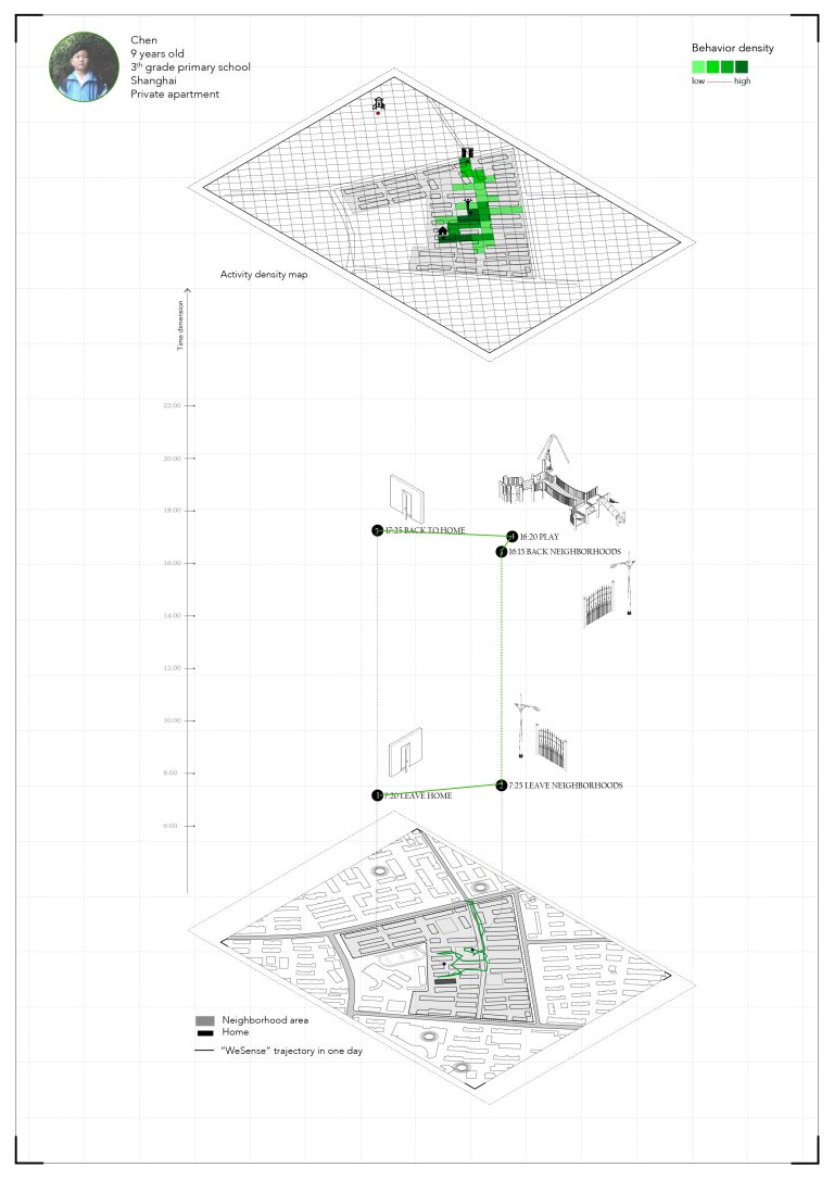
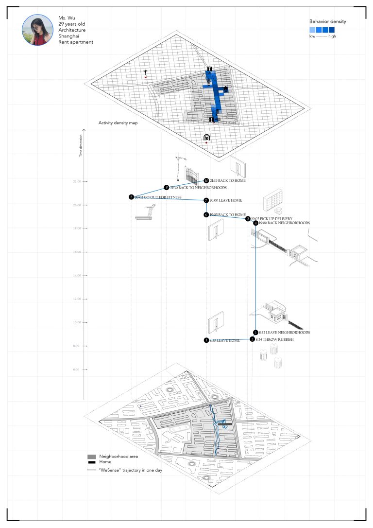
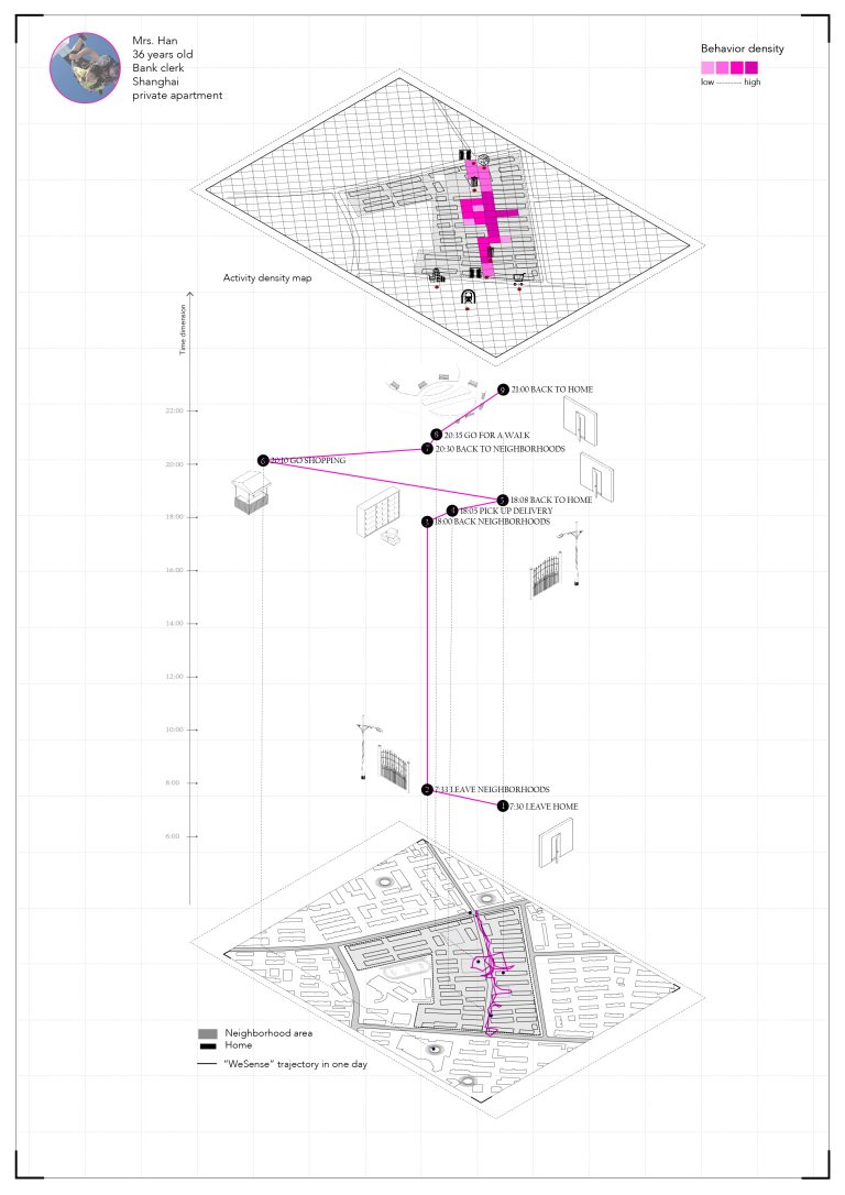
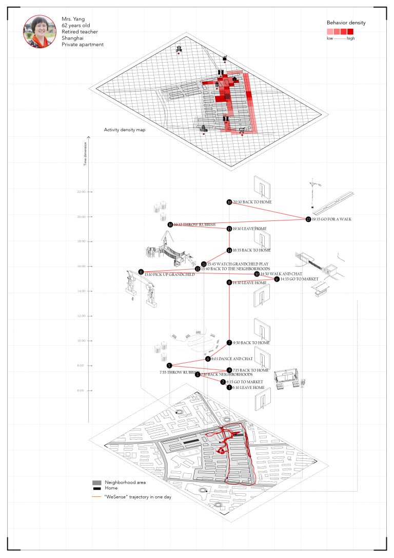
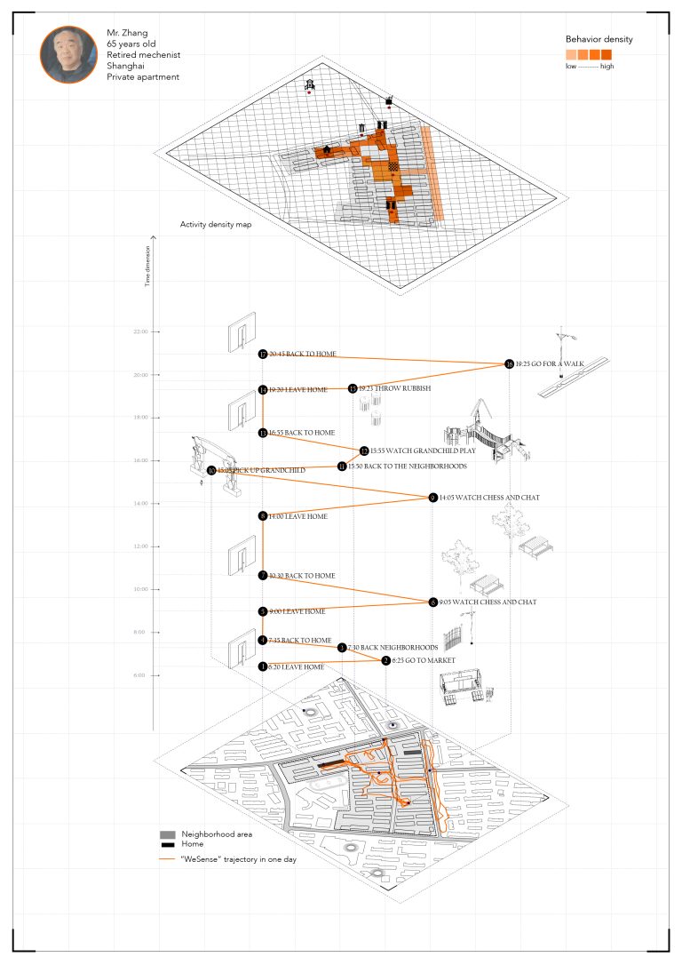
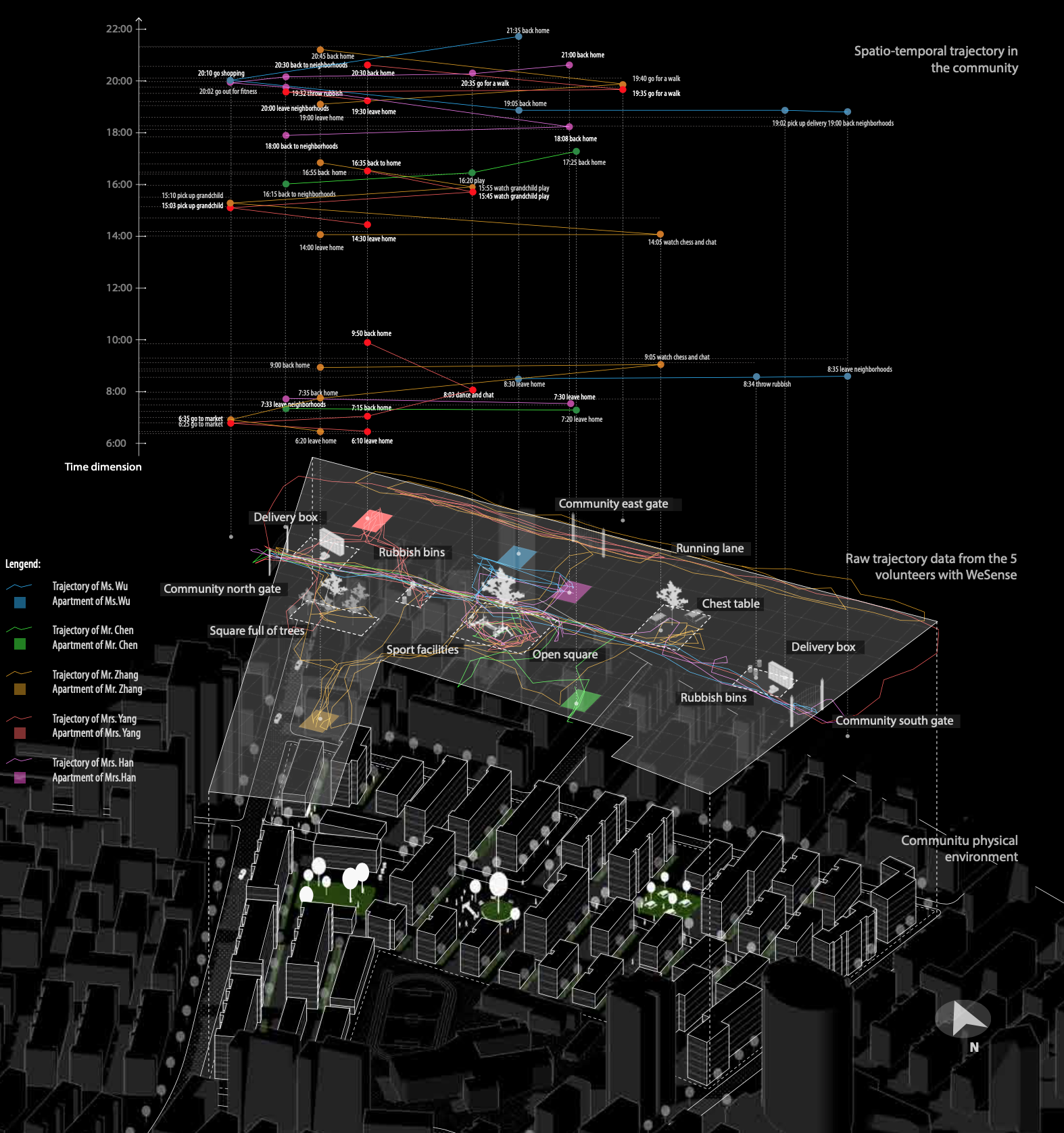
(1) Elder people and children volunteers rely more on the public facilities and spaces than other age groups;
(2) The public space is used in an unexpected way without following the top-down planning;
(3) Public spaces are fragmented in both spatial and temporal dimen- sions. A place usually holds various activities at different periods in a day.
This study has provided a prototype to collect and quantitate human behavior data with emerging information technologies. Combined with physical environment characteristics (e.g. sunlight analysis, view sight analysis, etc.), the association between human behavior and community environment could be analyzed. With the appropriate sampling method, the study method can be applied to other community-scale spatial analysis.